IoT and Drones Automate Field Operations
IoT-enabled drone technology has brought cost and operational efficiency to various industries.
June 23, 2021

By Mary Shacklett
As the Internet of Things sweeps through a variety of industries, it has started to make its mark by reducing costs and optimizing efficiency. In August, 2019, for example, McKinsey reported that Technology advances had reduced field operation costs by 10%-40% and improved overall field operations productivity by 30%-40%.. Key technology drivers were intelligent and prescriptive action boards, artificial intelligence and machine learning.
While many of these field operation advances are in on-the- ground applications such as smart city monitoring, predictive manufacturing, field-based asset management and logistics optimization, IoT and drones are also “taking flight.”
“We have really seen drone interest pick up,” said Mike Winn, CEO of DroneDeploy, a provider of drone and UAV (unmanned aerial vehicle) mapping software. Winn’s observations cohere with a 2021 study conducted by Research Dive, which projects a 19.9% CAGR growth in drone revenue through 2017. growth in drone revenues through 2027.
Drivers of Drone and IoT Adoption
IoT-enabled drone adoptionis delivering operational efficiencies and savings in the field.
Here is a sampling of some of these efficiencies:
Construction. For years, the construction industry has struggled with cost overruns and a chronic inability to monitor progress, track equipment, and manage projects and coordinate efforts at sites that are geographically dispersed from each other. Now, drone flights can document material supplies and work progress, facilitating better project management and cost savings.
Until recently, it wasn’t uncommon for a traffic accident on a major interstate to tie up traffic for hours and for miles. Now with the aid of drones, both law enforcement and insurance companies can “get on-site” quickly, documenting the physical details of accidents with drones, and without having to wait for physical crews to be dispatched to do the work “by hand.” The use of drones has reduced time to document from 2 to3 hours to 20 to 30 minutes. https://www.pix4d.com/blog/drone-mapping-crash-investigation.
Mining and gas. In mining and natural gas exploration, difficult-to-access areas with challenging topographies can now be mapped by drones, eliminating the need and cost of field crews, along with the hazards they might be exposed to.
The military uses drones to execute dangerous reconnaissance missions, eliminating the risks these operations present to human personnel who would otherwise have to perform them.
Health care. Drones have been used to deliver urgently needed medical supplies to populations that live in remote and isolated areas of the world.
Each example is unique, but all have a common theme: The benefits of drone use are immediately recognizable, and cost reductions and operational efficiencies are gained.
IoT’s Role in Drones
What makes drones effective in company operations is the IoT-generated data that powers them.
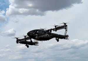
The outer chassis of the drone is constructed from lightweight materials that facilitate flying and minimize vibration and sound. The IoT sensors and navigational system are placed in the nose of the drone, and the rest of the drone body is outfitted with other IoT technology that is necessary to perform the drone’s mission. This IoT technology can range from GPS systems, central control systems, infrared laser and cameras; to LiDAR (light detection and ranging) instrumentation, photogrammetry equipment and inertlal measurement units (IMU) that measure rotational elements like pitch, roll and yaw. All of these systems are controlled from a ground field system, and they work together to produce an operational result.
Bathymetry is the study of underwater depth of ocean floors, lake floors and riverbeds. To measure water depth, crews use echo sounders, which transmit sonar sound waves into water and then determine depth measurements based upon the data that is bounced back from these waves.
Unfortunately, in some situations, it is impossible to lower an echo sounder into the water to take measurements. Examples include bodies of water where the seaweed is so dense that the water is impenetrable, or rock debris and other waste (known as tailings) that are left behind and that render water impenetrable after a mining operation has been completed.
As a workaround in these situations, an echo sounder can be loaded onto a drone which uses a combination of its own IoT systems in conjunction with the echo sounder’s ability to measure sound waves that can still bounce off the bottom of a body of water to measure depth, even though the echo sounder is airborne on the drone and not submerged in the water. Offsets are figured in for the space between the drone and the water’s surface, and also for any rotational or flight-related angles created by the drone’s fight pattern. The end result is highly accurate measurements.
“It can be better to use a drone with an echo sounder for mapping,
measuring and inspecting tasks and environmental monitoring if you are conducting bathymetric surveys of tailings dams and ponds,” said Alexey Dobrovolskiy, CTO at SPH Engineering , which provides software and integration services for unmanned systems. “Also, drones can be used for river and lake bottom profiling for scientific investigations and environmental monitoring,
underwater inspections for engineering works such as bridge or pipeline crossings, and for
sludge volume measurements at waste stabilization ponds.”
The Next Step for IoT and Drones
The use of IoT and drones n field operations has potential, but the legal and regulatory fields still need to catch up.
In the U.S., Congress and the Federal Aviation Administration have moved slowly, taking time to consider the public impact of commercial drones before issuing licenses to those who would like to use drones for expanded commercial purposes. The present guideline is that drones cannot be flown over 400 feet of altitude, to prevent interference with other types of aircraft. Commercial field operators are also required to be licensed and certified to fly drones, and they must retain line-of-sight contact with the drones they fly.
As for the physical drones themselves, batteries are still an issue. The average drone flight is 30 minutes. This time in the air is shorter if the drone must battle a headwind. Battery life limitations make it important for companies to plan drone missions carefully.
You May Also Like
